Site Hits: 18,353,281


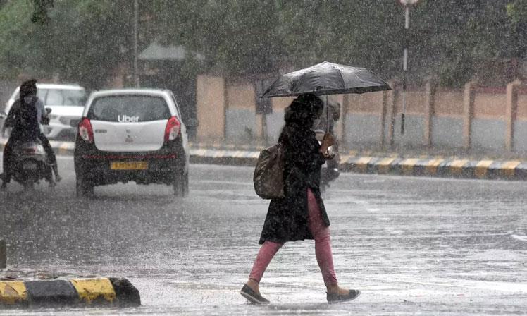
Heavy Rainfall Predicted in Next 3 Days in North, Northeast & South India, Says IMD
1st Sep, 2020
The India Meteorological Department (IMD) on Monday predicted heavy to very heavy showers in parts of north, northeast and south India in the next three days, highlighting that the country recorded its highest rainfall in 44 years in the month of August.
Nearly 5,000 people were shifted to safer places in Gujarat's Bharuch and Vadodara districts after flooding in several villages due to rise in level of the Narmada river, while over 3,000 people have been evacuated from Bhandara and Chandrapur districts of Maharashtra's Vidarbha after heavy downpour in neighbouring parts of Madhya Pradesh.
In Delhi the water level of the Yamuna was receding gradually and the river was flowing below the warning mark in Delhi. Light to very light rain and thundershower occurred at isolated places in Uttar Pradesh, and heavy rains were recorded in several parts of Rajasthan.
The IMD said heavy to very heavy rainfall is very likely at isolated places in west Rajasthan on September 1. Heavy falls are likely in isolated parts of Punjab, east Rajasthan, Bihar, West Bengal, Sikkim, Odisha, Assam, Meghalaya, Arunachal Pradesh, Nagaland, Manipur, Mizoram, Tripura, Andhra Pradesh, coastal and south interior Karnataka, Tamil Nadu, Puducherry, Karaikal, Kerala and Mahe, it added.
Strong wind with speed reaching 45-55 kmph is very likely over the southwest Arabian Sea. Squally weather with wind speed reaching 40-50 kmph is likely over south Andaman Sea and adjoining equatorial Indian Ocean, the IMD said.
Heavy to very heavy precipitation is expected at isolated places in Odisha, south interior Karnataka, Tamil Nadu, Puducherry, Karaikal and Kerala and Mahe on September 2.
It said heavy falls are likely in isolated places of Jammu & Kashmir, Ladakh, Gilgit-Baltistan, Muzaffarabad, Himachal Pradesh, Uttarakhand, Punjab, Haryana, Chandigarh, Delhi, Rajasthan, Uttar Pradesh, Chhattisgarh, Bihar, Jharkhand, Andaman & Nicobar Islands, Assam, Meghalaya, Odisha, coastal Andhra Pradesh, Yanam, Rayalaseema, coastal Karnataka and Lakshadweep on September 2.
In its flood advisory, the Central Water Commission said the water level of Chambal river and its tributaries, and the Mahi river in Madhya Pradesh and east Rajasthan are expected to rise rapidly.
Gandhisagar dam, Som Kamala Amba dam, Kalisindh dam, Mahi Bajaj Sagar dam, Panchana dam in Madhya Pradesh and Rana Pratap Sagar dam and Kota Barrage in Rajasthan are expected to get heavy inflows, it said.
Close watch is to be maintained in districts Dhar, Mandasour in Madhya Pradesh and Tonk, Banswara, Udaipur, Jhalawar, Baran, Chittorgarh, Karrauli, Bundi, Dholpur and Kota in Rajasthan, it added.
The CWC said the Narmada, Mahi, Sabarmati rivers in Gujarat, and west flowing rivers in Konkan and Goa are expected to rise in the next three days.
"Kadana Dam, Ukai Dam, Panam Dam, Madhuban Dam, Sardar Sarovar Dam and Dharoi Dam in Gujarat are expected to get increased inflows. Close watch is to be maintained in the districts of Narmada, Bharuch, Mahisagar, Mehsana, Tapi, Valsad, Panchmahal, Ahmedabad, Banaskantha and Mehsana in Gujarat," the CWC said.
The MeT department said heavy to very heavy rainfall is also very likely at isolated places of Odisha, south interior Karnataka, Tamilnadu, Puducherry, Karaikal and Kerala, Mahe on September 3 and 4.
The Met said the country saw 27 per cent more rainfall this August, fourth highest in the last 120 years. The overall rainfall recorded in the country from June 1 to August 31 was 10 per cent more than normal, it added.
"Rainfall recorded in August 2020 is fourth highest in the last 120 years and highest in 44 years," R K Jenamani, scientist at the IMD's national weather forecasting centre, said. In Madhya Pradesh, excess rainfall and flooding have damaged crops in seven lakh hectare area of 14 districts of the state, Chief Minister Shivraj Singh Chouhan said, assuring farmers that all possible measures will be taken to compensate them.
The cumulative water storage of 248 important dams in Madhya Pradesh stood at 84.1 per cent of capacity on Monday, officials said. In Gujarat, due to continuous inflow of water from upstream in the Sardar Sarovar Dam over the Narmada near Kevadia village, 9.86 lakh cusec water is being released into the river, officials said.
The water level of the dam has reached 132.63 metres as against its full reservoir level of 138.68 metres, it said. As a result, the level of the Narmada river has risen significantly and water has started entering the low-lying villages situated on its banks in Vadodara and Bharuch.
In Maharashtra, 2,830 people have been rescued from Bhandara city of East Vidarbha in the last two days, and 500 people have been evacuated from the flooded Ladaj village in Chandrapur. Floodwater is now receding, but rescue operations are still underway.
Up north, a cloud cover and patchy rains kept temperatures within comfortable levels in Delhi, and the maximum temperature settled at 33.2 degrees Celsius, a notch below normal. Humidity levels shot up to 95 per cent.
On and off light rains will continue in the city over the next six days, the Met department said, adding that moderate rainfall is likely on Thursday.
Landslides and mudslides triggered by heavy rains blocked the 270-km-long Srinagar-Jammu national highway at several places in Ramban district on Monday, leaving over 300 vehicles stranded. In Punjab and Haryana, the maximum temperatures hovered close to normal limits, with Chandigarh recording a high of 32.5 degrees Celsius.


Leave a comment: (Your email will not be published)